
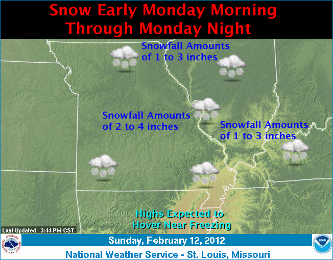
A winter storm system will impact Central Missouri today (Monday), potentially bringing from one to four inches of snow into the region by tonight.
The National Weather Service reports the snow will spread eastward across the area during the morning and persist through the day into tonight. Forecasters believe the heaviest snowfall will occur during the afternoon hours.
Storm totals of one to four inches of snowfall are expected with some sleet accumulations possible across Southeast Missouri. The snowfall is expected to come to an end late tonight but may mix with light freezing drizzle at that time.
Forecasters issued the following winter weather statement:
- TIMING: SNOW WILL BEGIN JUST AFTER SUNRISE THIS MORNING AND PERSIST INTO THE EVENING HOURS. THE HEAVIEST SNOWFALL IS EXPECTED TO OCCUR DURING THE AFTERNOON HOURS.
- ACCUMULATIONS: SNOWFALL ACCUMULATIONS OF 1 TO 4 INCHES ARE ANTICIPATED.
- WINDS: SOUTHERLY WINDS AT 10 TO 15 MPH WITH GUSTS TO AROUND 20 MPH.
- IMPACTS: THE HEAVIEST SNOWFALL IS EXPECTED TO OCCUR DURING THE AFTERNOON COMMUTE RESULTING IN HAZARDOUS DRIVING CONDITIONS.
PRECAUTIONARY/PREPAREDNESS ACTIONS:
A WINTER WEATHER ADVISORY IS ISSUED FOR A VARIETY OF WINTER WEATHER CONDITIONS...SUCH AS SNOW, BLOWING SNOW, SLEET OR FREEZING DRIZZLE AND RAIN. IT ONLY TAKES A SMALL AMOUNT OF WINTRY PRECIPITATION TO MAKE ROADS, BRIDGES, SIDEWALKS AND PARKING LOTS ICY AND DANGEROUS. IT IS OFTEN DIFFICULT TO TELL WHEN ICE BEGINS TO FORM, SO DO NOT BE CAUGHT OFF GUARD.
Additional resources:
Local forecast, radar, advisories
School closings and weather-related announcements for Monday, Feb. 13, 2012