
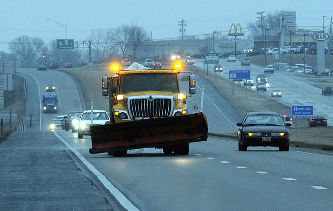
Winter weather may not have arrived in Jefferson City as soon as meteorologists expected, but it did arrive.
Persistent light drizzle that started early in the afternoon Saturday began causing travel hazards shortly after sunset.
By 7 p.m., roads, sidewalks and vehicles were covered in a treacherous thin layer of ice.
Downtown streets became hazardous; a fire truck was stranded on Monroe Street early Saturday evening.
Emergency personnel were called to several traffic accidents.
Forecasts initially called for freezing rain to begin falling Friday night while city residents slept. The weather event was to begin in Jefferson City about 1 a.m., and to continue until about 6 a.m. Saturday.
Anticipating dangerous driving conditions, organizers canceled several local events.
One was the groundbreaking ceremony for Jefferson City's second high school, scheduled to begin at 11 a.m.; it was set back a week.
While the freezing rain didn't materialize Saturday morning, it did so later in the day. And a National Weather Service winter weather advisory remained in effect until 6 a.m. this morning.
Sleet and freezing rain continued overnight, with the possibility of snow forecast to end by late this morning.
NWS meteorologist Jayson Gosselin, in St. Louis, said Jefferson City was on the edge of any hazardous precipitation that could fall in Central Missouri.
"We have seen reports of snow, sleet, and freezing rain and freezing drizzle," he said. "It should continue through the evening hours until about 3 a.m. or so."
Any precipitation early Sunday morning was expected to be in the form of light snow. By late morning today, the snowfall should end.
Gosselin added there would be a mid-week warming trend. A couple of days this week could see high temperatures in the 50s, or maybe reaching 60.
"It will get colder after that," he added. "It is, after all, February."
_
ADDITIONAL RESOURCES:
MoDOT statewide traveler information map