
A winter storm advisory from now until 6 a.m. Thursday has replaced the warning that was issued earlier.
Central Missouri's Audrain, Boone, Callaway, Cole, Gasconade, Maries, Moniteau, Morgan and Osage counties are included in the potentially affected area, among others.
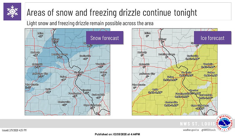
The NWS has issued the following weather statement for Mid-Missouri:
...WINTER WEATHER ADVISORY IN EFFECT UNTIL 6 AM CST THURSDAY... ...WINTER STORM WARNING IS CANCELLED...
WHAT...Snow. Additional snow accumulations of around one inch.
WHERE...Portions of central, east central and northeast Missouri and southwest and west central Illinois.
WHEN...Until 6 AM CST Thursday.
IMPACTS...Plan on slippery road conditions. The hazardous conditions could impact the evening commute.
PRECAUTIONARY/PREPAREDNESS ACTIONS... A Winter Weather Advisory for snow means that periods of accumulating snow will primarily cause travel difficulties. Roads may rapidly become slippery once the snow begins, so motorists should plan for a slower than normal trip. Be especially alert when approaching bridges, overpasses, and curves. In Illinois, the latest road conditions can be obtained on the Internet at www.gettingaroundillinois.com. In Missouri, the latest road conditions can be obtained on the Internet at traveler.modot.org/map/ or by calling 1-888-275-6636.
Additional resources:
MoDOT statewide traveler information map