

For additional updates, see Closings for Thursday and Closings for Friday.
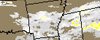
Also see: Area forecast, radar and advisories
UPDATE 6:14 p.m.
The latest National Weather Service statement for Mid-Missouri:
...WINTER STORM WARNING REMAINS IN EFFECT UNTIL MIDNIGHT CST TONIGHT...
- TIMING... PERIODS OF SNOW AND SLEET CAN BE EXPECTED THIS EVENING... TAPERING OFF TO FREEZING DRIZZLE.
- ACCUMULATIONS...TOTAL SNOW AND SLEET ACCUMULATION OF 7 TO 12 INCHES... ALONG WITH UP TO ONE TENTH OF AN INCH OF ICE.
- WINDS...EAST 5 TO 15 MPH WITH GUSTS UP TO 30 MPH.
- IMPACTS...HEAVY SNOW...SLEET AND ICE ACCUMULATIONS WILL HAVE SIGNIFICANT IMPACTS ON TRAVEL. ICE MAY CAUSE DAMAGE TO TREES AND POWER LINES.
UPDATE 6:09 p.m.
Snow snarls traffic on Missouri highways
COLUMBIA, Mo. (AP) - Winter weather has snarled traffic all across Missouri.
The Missouri Department of Transportation reported Thursday a strong winter storm forced parts of Interstate 70 and Interstate 64 to be closed during some periods.
Spokeswoman Holly Dentner says the Missouri State Highway Patrol directed traffic off westbound I-70 between mile markers 212 and 216 near St. Louis. Eastbound and westbound lanes on I-64 had to be closed between the Missouri River and Interstate 270.
Farther west in Columbia, I-70 became so clogged with stalled traffic during the afternoon that MoDOT posted the highway as closed on its website.
See also: MoDOT Traveler Information map
UPDATE 5:38 p.m.
Snowstorm shuts down KC airport
KANSAS CITY, Mo. (AP) - All flights into and out of Kansas City International Airport have been canceled for the night after a major winter storm dropped as much as 10 inches on the area.
Airport officials announced on Twitter at 4:30 p.m. Thursday that crews would work through the night to prepare for reopening at 7 a.m.
Friday. Earlier in the day, officials said whiteout conditions had forced the airport to shut down after conditions first had reduced air traffic to a single runway, and maintenance workers were having trouble seeing each other through the blinding snow.
Travelers were being urged to check their flights frequently and monitor local media before making the trek to the airport.
- Weather News
- Closings
- Severe Weather Update
- Weather radar
- Road closings
- Power failures map
- Storm Galleries
- Submit photos
- Share stories
UPDATE 2:59 p.m.
The Jefferson City School District announces its schools will not be in session Friday due to inclement weather and hazardous road conditions. The district will post additional information regarding specific events scheduled for Friday as they come, according to David Luther, assistant to the superintendent.
In Jefferson City, the ABB plant has canceled its second and third shifts due to the weather. Scholastic has canceled its second and third shifts.
UPDATE 2:15 p.m.
As of 2 p.m. today forecasters at the National Weather Service in St. Louis called for the south side of Jefferson City to get around 8-9 inches of snow and areas around the Missouri River getting 10 inches of snow when this is all said and done.
By Friday the precipitation is expected to be done.
Temperatures will stay around freezing Friday and Saturday and climbing above that by Sunday so expect the snow and ice to stay around for a few days.
UPDATE 1:15 p.m.
Due to the inclement weather and dangerous road conditions throughout the city, the Jefferson City Police Department would like to remind motorists to use extreme caution when driving on the roadways. While city personnel are working to clear roads, the significant amount of snowfall in the area is causing additional difficulties and some accidents. Future potential snowfall and freezing conditions will only serve to worsen the roadway situation.
Jefferson City police are utilizing the existing police fleet of unmarked four-wheel drive vehicles to respond to calls, as well as some marked units. All personnel responding to calls for service are in uniform, and we are responding to calls in their order of level of emergency.
Motorists that choose to drive must use their headlights, as their wipers are activated during the snowfall. If citizens decide to travel, they are encouraged to do so only if necessary,
UPDATE 12:15 p.m.
University of Missouri cancels classes
COLUMBIA, Mo. (AP) - Classes at the University of Missouri-Columbia have been cancelled due to severe winter weather.
The university announced at noon that all classes and exams are cancelled effective immediately. Columbia College has also cancelled its remaining classes.
This is the first time in two years the university has cancelled classes due to weather conditions.
Columbia roads are completely covered with snow and ice. Drivers are saying visibility is very low and the roads are slick.
UPDATE 11:32 a.m.
Flights cancelled at Columbia airport
COLUMBIA, Mo. (AP) - American Airlines has cancelled its flights into and out of the Columbia Regional Airport because of a winter storm.
The two afternoon flights to Dallas and Chicago were scratched Thursday, as were its scheduled arrivals.
An earlier 6:45 a.m. flight to Dallas was able to depart.
As of 11 a.m. most reports into the National Weather Service in St. Louis from Jefferson City showed 2-3 inches of snowfall since the storm hit around 7:30 a.m.
"We'll probably see intense precipitation continue until about 1 p.m." said Meteorologist Scott Truett. "Just like with the initial shot, we will continue to have thundersnow in the afternoon."
Truett said they expect precipitation to become lighter from 2-5 p.m. and by this evening only light snow or drizzle would be left.
In Jefferson City, JeffTran, the city's bus system, has been suspended for the remainder of the day due to the weather.
UPDATE 10:45 a.m.
Storms bring 'thundersleet' to Ozarks
SPRINGFIELD, Mo. (AP) - You may have heard of the phenomenon known as "thundersnow."
But have you ever heard of "thundersleet?"
Springfield radio station KTTS reports that's a problem now in southwest Missouri, where the winter storm that's dumping huge amounts of snow in the north is bringing sleet and ice to the south.
In "thundersnow" events, thunderstorms form higher in the atmosphere where temperatures are warmer. That rain turns to snow before reaching the ground, with the above thunderstorm pushing the precipitation down with extra intensity.
Today, that precipitation is becoming sleet across portions of southwest Missouri, and it's causing concerns about collecting on power lines.
So far, only a handful of power outages have been reported.
---
Information from: KTTS-FM, http://www.ktts.com
UPDATE 10:15 a.m.
Russellville schools cancelled last night in fear of this storm.
By Paula Earls California Democrat
The Russellville bus drivers were relieved not to have to be out on the roads and risk the safety of the Cole R-I students.
Cole R-I Athletic Director Heath Waters said they will follow the MSSHA rules in rescheduling the Class 2 District 8 Boys Semifinal round that was scheduled tonight at the high school.
Russellville High School parents are stoked that the #4 seeded Russellville boys are still in District play and are hoping they continue to win --but are very uncertain with all the snow and ice when they can practice or play again. The same is true for the #1 seeded Russellville girls who won the semifinal round last night. They are scheduled to play for the championship on Friday against the Linn Lady Wildcats. However the games may be delayed due to the weather.
The city has hired a private contractor to clear the city streets, according to Mayor Ritchie Jenkins.
Friends and neighbors are in awe at the thunder and lightening. It is lightening the dim skies over Russellville and shaking houses extremely hard. Residents are remembering the snow thunder and 18 inches of snow from a couple of years ago. Many say they will stay in today since the county road crews have not plowed as of 10 a.m., Thursday.
For the few that tried to leave for work this morning, several had minor slide-offs that sent them back home for the day. With the state only making necessary employees attend work several folks were greatly relieved not to venture out.
Highway C is still awaiting attention from the Cole County Road Crew. Highway 50 is very slick and dangerous according to a few travelers.
Currently Russellville has approximately 2 1/2 inches of snow with ice currently pelleting from the sky.
Snowstorm shuts down KC airport
KANSAS CITY, Mo. (AP) - Heavy snow has forced the closure of the Kansas City International Airport.
Airport officials announced on Twitter shortly before 10 a.m. that the whiteout conditions had forced the airport to shut down. Earlier, conditions had reduced air traffic to a single runway, and maintenance workers were having trouble seeing each other through the blinding snow.
It wasn't certain when the airport would reopen and how many flights were affected. Travelers are being urged to check their flights frequently and monitor local media before making the trek to the airport.
UPDATE 10 a.m.
All William Woods University offices will close at 11 a.m. today, and all classes are cancelled.
UPDATE 9:30 a.m.
All activities at Washington Park Ice Arena for today have been cancelled. The ice arena will re-open tomorrow.
UPDATE 9:15 s.m.
JeffTran, the city's bus system, will be suspended until noon today, when service will be re-evaluated.
UPDATE 9 a.m.
KANSAS CITY, Mo. (AP) - Snow is falling fast and furious across parts of Missouri.
Across wide sections of northwest Missouri, whiteout conditions dropped visibility to a point that made driving too risky. The winds and heavy snow -- falling as much as 2 inches per hour -- removed buildings from view.
In Kansas City, the skyline disappeared behind a veil of snow. Flakes were falling so fast that plows trying to cross the city simply couldn't keep up.
Kansas City was expected to get up to a foot of snow before the storm exits the region later Thursday. Areas north of the city could see more than a foot.
SPRINGFIELD, Mo. (AP) - A sheet of ice and sleet moved across southwest Missouri, leaving roads in the Springfield region treacherous for drivers.
The Missouri Department of Transportation says Interstate 44 in the region was completely covered with ice about 7 a.m., and urged drivers to use extreme caution or stay off the road. Three non-injury accidents were reported on the interstate about 7 a.m., contributing to slow traffic.
Springfield media reported heavy, freezing rain moved through the city around 6 a.m.
Other reports included three-fourths of an inch of sleet in Sarcoxie, a half-inch of sleet near Bolivar, three-quarters of an inch of ice in Hickory County and about a half-inch of hail around Pierce City. So far, there are no reports of widespread power outages.
UPDATE 8:56 a.m.
Missouri River Regional Library will close at 10 a.m. due to the snow
UPDATE 8:45 a.m.
Residential trash collection in Jefferson City will be suspended this
morning due to the inclement weather. Service will pick up where left off tomorrow and will
continue through Saturday to complete pick ups.
EARLIER REPORTS
The latest forecast from the National Weather Service in St. Louis is for today's winter storm to last most of the day.
"It will begin as snow and quickly mix with sleet and you might even get some lighting and thunder," said Meteorologist Wes Browning. "That's how intense this system is. It's going to go from no obstructions on the road to terrible driving conditions within in an hour or two. Very sudden and rapidly changing."
Browning said they expect the snow/sleet to last until 4-5 p.m.
"The bulk of precipitation will be snow mixing with sleet," he said. "We're looking at six to eight inches of snow for Jefferson City and on north. However, if it turns to all sleet that will reduce the snowfall totals. South of Jefferson City 2-4 inches of snow with an inch of sleet is expected.
"Any way you look at this it's going to be bad," Browning added. "Driving will be terrible."
The precipitation came in from the south, with Camden, Miller and Morgan Counties all reporting slick roads by around 7:25 a.m.
A Winter Storm Warning remains in effect in Mid-Missouri until midnight.
The NWS has issued the following weather statement:
- TIMING... PRECIPITATION WILL OVERSPREAD THE AREA THIS MORNING AND BECOME HEAVY AT TIMES DURING THE DAY BEFORE TAPERING OFF BY EVENING. PRECIPITATION IS EXPECTED TO BEGIN AS MOSTLY SNOW... MIX WITH SLEET AND FREEZING RAIN DURING THE DAY... AND TAPER OFF AS FREEZING DRIZZLE DURING THE EVENING.
- ACCUMULATIONS...SNOW ACCUMULATION OF 2 TO 8 INCHES...ALONG WITH A LIGHT GLAZING OF ICE. THE HIGHER SNOWFALL AMOUNTS WILL TEND TO OCCUR NORTH OF INTERSTATE 70.
- WINDS...EAST 10 TO 20 MPH WITH GUSTS UP TO 30 MPH.
- IMPACTS...HEAVY SNOW...SLEET AND ICE ACCUMULATIONS WILL HAVE SIGNIFICANT IMPACTS ON TRAVEL. ICE MAY CAUSE DAMAGE TO TREES AND POWER LINES.
- PRECAUTIONARY/PREPAREDNESS ACTIONS... A WINTER STORM WARNING MEANS THAT A SIGNIFICANT AMOUNT OF SNOW... SLEET AND/OR ICE IS EXPECTED OR OCCURRING. STRONG WINDS ARE ALSO POSSIBLE.
Additional:
Weather-related school closings, announcements for Thursday, Feb. 21, 2013